

UH Dept. of Earth & Atmospheric Sciences | UiS Dept. of Petroleum Engineering
|
|
UH Dept. of Earth & Atmospheric Sciences | UiS Dept. of Petroleum Engineering |
|
| Home | About Us | Maps | Articles & Reports | Lesson Plans | Consortium Compendium | References | Field Trip Guides | Software and Links | Search | CBTH Homepage |
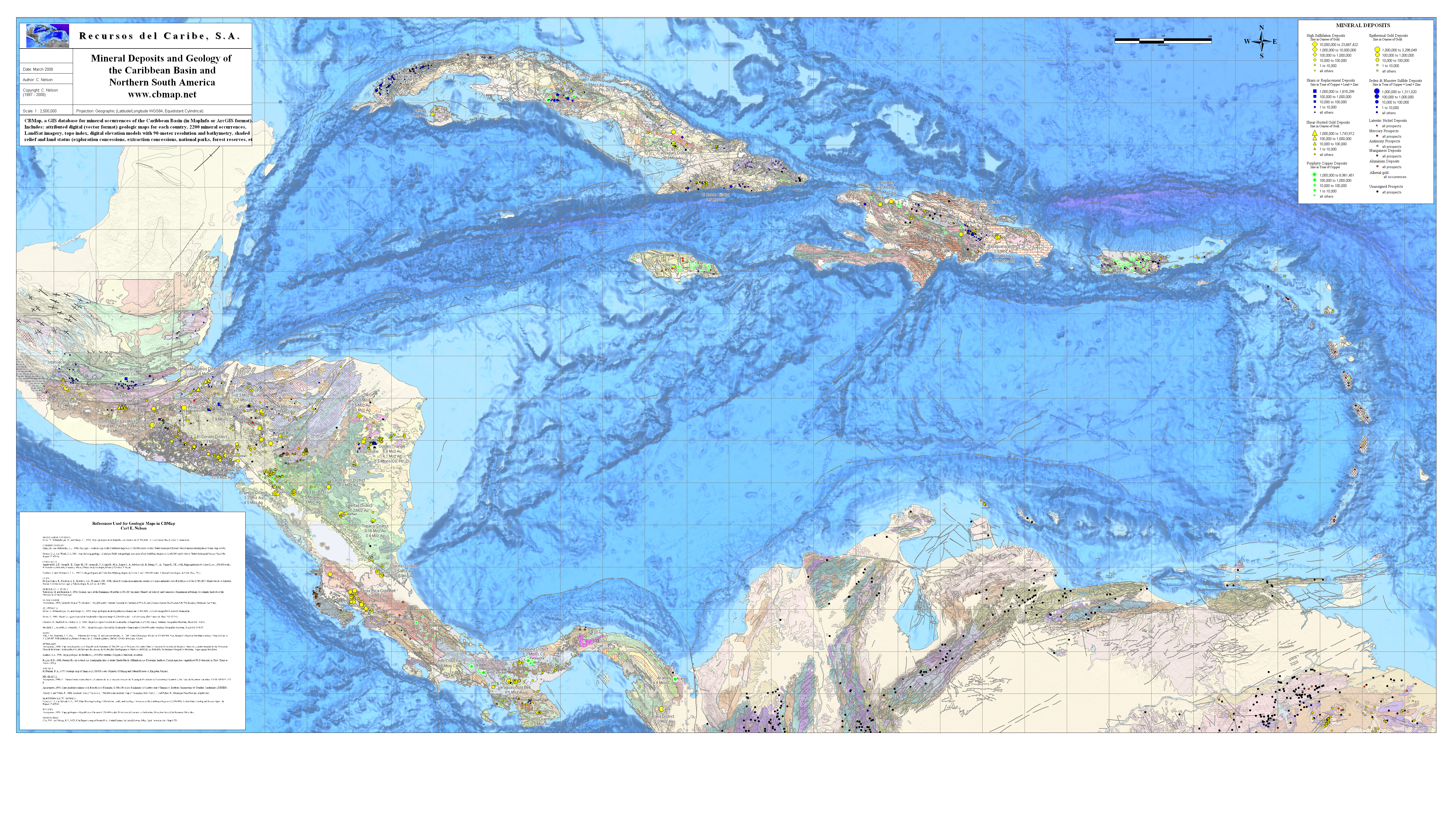
Caribbean Maps |
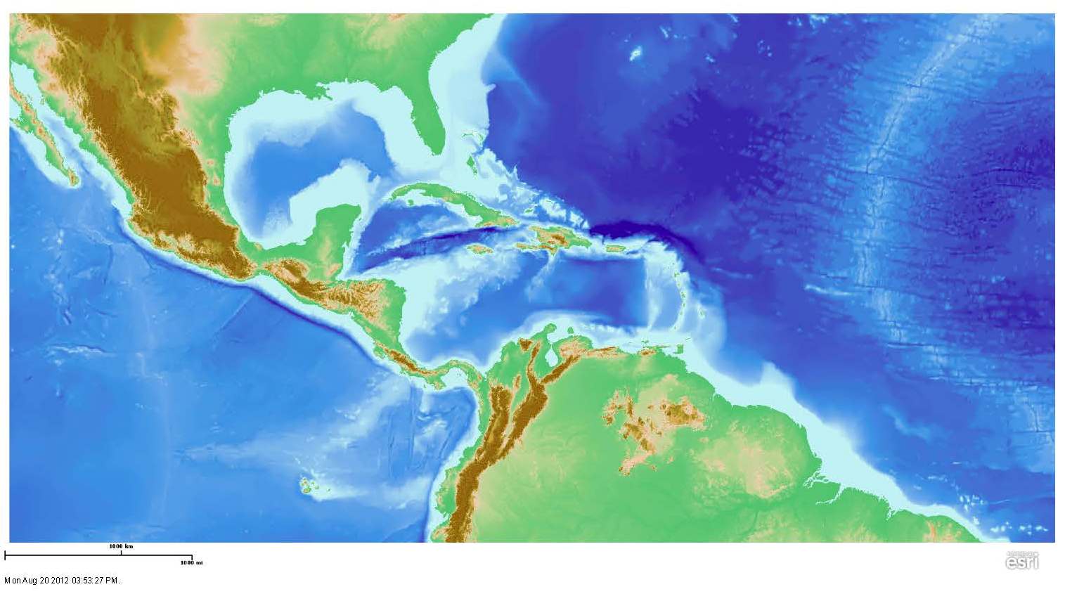
Topography and Bathymetry Map of the Caribbean and Northern South American Region (Caribbean Basins, Tectonics, and Hydrocarbons Project, 2011) 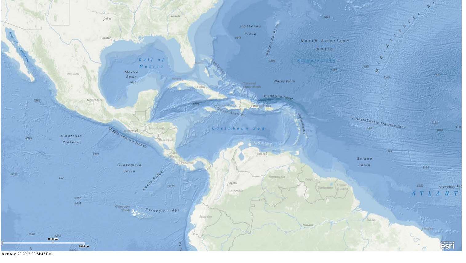
Political Boundaries Map of the Caribbean and Northern South American Region (Caribbean Basins, Tectonics, and Hydrocarbons Project, 2011) 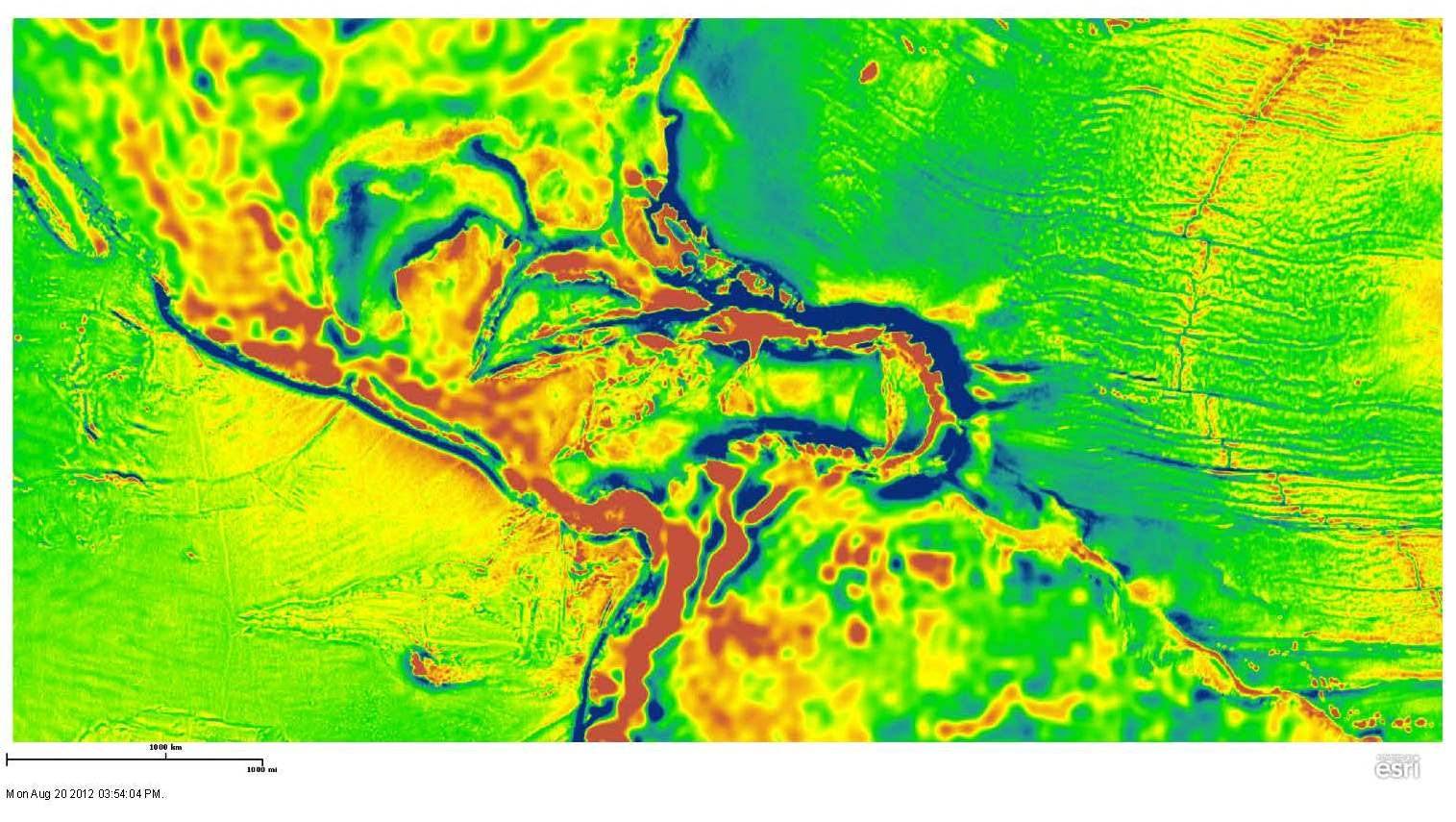
Free-Air Gravity Map of the Caribbean and Northern South American Region (Caribbean Basins, Tectonics, and Hydrocarbons Project, 2011) 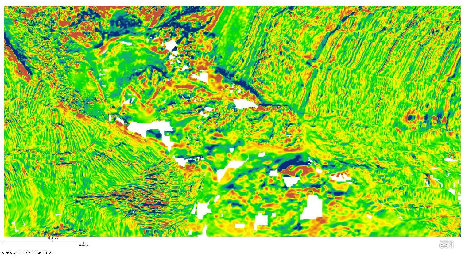
Magnetic Anomalies Map of the Caribbean and Northern South American Region (Caribbean Basins, Tectonics, and Hydrocarbons Project, 2011) |
Links to Other Maps
|
| CBTH K-12 Outreach | ||||||||
|
||||||||